Monday, July 29, 2013

River Tracing at MaSu River 瑪鋉溪溯溪* River Tracing Skills Training ~ 2013/8/18 (Sun.)

River Tracing at MaSu River 瑪鋉溪溯溪* River Tracing Skills Training ~ 2013/8/18 (Sun.)
Limit: 14 people

★ Registration deadline: 2013/8/7 (Wednesday)

MaSu River is at Wanli, Taipei. It is famous for its continuous waterfalls, deep ponds, and gorge. It is a very interesting river for river tracing. In addition, the various terrains make this river a great place for river tracing training.
We will learn many river tracing skills during our trip: climbing waterfalls, swimming through deep ponds, rappelling, belaying, equipment usage, and knot skills. These river tracing skills are also very useful for passing cliffs or streams while hiking.

Event Pictures:
1. http://blog.xuite.net/lairoachy/blog/62068376-20120728+冷涼卡好瑪鋉溪
2. http://qing4100.pixnet.net/blog/post/49735416-瑪鋉溪溯溪~離台北最近的避暑天堂
3. http://www.youtube.com/watch?v=FV93KKaGLUU

★ Leader:YiRu Li 0988-580-662, yiruli09@gmail.com ; 阿不拉

★ Gathering Time: 2013/8/18 (Sunday) AM 8:00
(Please be on time because we’ll depart at AM 8:20.)

★ Gathering Place:Taipei MRT Shilin Station Exit 2 士林捷運站二號出口

★ Deadline to register:2013/8/7 (Wednesday)

★ How to register:
The registration form must be forwarded to yiruli09@gmail.com & topolinachen@gmail.com with the following personal information (After 10 people register and we are sure to go, we will give you a payment notice):

1. Activity Name/Date
2. Name
3. Passport number
4. Gender
5. Blood Type
6. Date of Birth (yyyy/mm/dd)
7. Nationality
8. Occupation
9. Address
10. Home tel.
11. Office tel.
12. Cell phone
13. E-mail
14. Emergency Contact: Name and Relationship
15. Emergency Contact Phone Number
16. Vegetarian (yes or no)
17. Foot length (cm, for preparing river tracing boots), Weight, Waist size (for preparing life jackets and harnesses)
(Just registering here on the 523 Facebook page is not acceptable.)

★ Fee:
Non-member NT 1,500, Member NT 1,400
(After we have at least 10 people and are sure to go, we will give you a payment notice.)
The fee includes Guiding, Insurance (Three Million NTD), Transport, Life jackets, River Tracing Boots, Helmets, Harnesses, a safety fund, and administrative costs.
(Want to be a 523 member? NT 500/person or NTD 800/family member, with validity 1/1~12/31)

★ Itinerary:
8/18 (Sunday) 8:00 Meet everyone at Taipei MRT Shilin Station Exit 2 士林捷運站二號出口--> 9:30 Arrive where the river tracing begins --> 15:00 Arrive at a farm. Take a rest and drink tea. --> 16:00 Start walking back to trailhead. --> 18:00 Arrive to Taipei MRT Shilin Station.

★ Personal Equipment:
A towel, A change of clothes, Lunch, Water (1 liter), Sun/Rain protection, Small Backpack (Waterproof).
* Personal belongings must be put in waterproof bag or put in at least two layers plastic bags. Be careful of your electronic products if you bring them. Make sure if your camera is waterproof if you would bring one.
* You'll be able to leave things in the van.
* Please wear clothes which are easy-dry and suitable for swimming & climbing.

★ Points for Attention:
1. Please follow the team leader’s instructions. Do not leave the group.
2. If you feel unwell during the trip, please let the team leader know immediately.
3. At least 10 people are required for this activity to proceed. If less than 10 people register, the activity will be cancelled.
4. Participants who cancel more than 5 days before the trip will receive a 50% refund of their registration fees. Unfortunately, no refunds can be given to participants who cancel in the 5 days before departure.
5. In the event of typhoons, closure of the mountain, or other factors beyond our control, we will either postpone or cancel the activity based on official announcements from the meteorological authorities or relevant government departments. If participants are forced to cancel because they are unable to attend a rescheduled activity, they will receive a refund minus NT200 for insurance and administrative costs.
Thank you for your understanding!
6. In the event that the closure of the mountain during the trip forces us to abandon our original itinerary, the association reserves the right to alter the original itinerary, destinations visited, or food and accommodation provided. If any cost savings are made as a result, they will be refunded to participants after the trip is completed.


★ 瑪鋉溪溯溪2013/8/18 (日) 限14人

夏日清涼有勁的溯溪行! 瑪鋉溪地形多變, 包含峽谷, 深潭, 連續瀑布, 刺激好玩. 專業教練指導學習各樣溯溪技巧, 裝備使用及繩結用法.

瑪鋉溪溯溪網路紀錄分享:
1. http://blog.xuite.net/lairoachy/blog/62068376-20120728+冷涼卡好瑪鋉溪
2. http://qing4100.pixnet.net/blog/post/49735416-瑪鋉溪溯溪~離台北最近的避暑天堂
3. http://www.youtube.com/watch?v=FV93KKaGLUU

★ 領隊:YiRu Li 0988-580-662, yiruli09@gmail.com ; 阿不拉

★ 集合時間: 2013/8/18 (日) AM 8:00

★ 集合地點: 士林捷運站二號出口

★ 報名截止日: 2013/8/7 (三)

★ 報名方式:
請將以下報名資料寄至 yiruli09@gmail.com & topolinachen@gmail.com (確定成行後另行通知繳費)

1. 參加活動名稱/日期
2. 姓名
3. 身份證字號
4. 性別
5. 血型
6. 出生年月日
7. 國籍
8. 職業
9. 通訊地址
10. 住家電話
11. 公司電話
12. 行動電話
13. E-mail
14. 緊急聯絡人姓名/關係
15. 緊急聯絡人電話(台灣地區)
16. 素食與否
17. 腳長度(公分, 用以準備溯溪鞋), 體重, 腰圍(用以準備救生衣及吊帶)
(不接受只在523臉書上的報名登記)

★ 費用:
非會員:1,500元,會員:1,400元 (確定成行後:至少10人報名, 另行通知繳費)
費用包括溯溪教練指導、保險(300萬元)、交通、救生衣、溯溪鞋、頭盔、吊帶、安全基金及行政等費用
(想成為523會員?個人會費每人500元或家庭會費800元,有效期為1/1~12/31)

★ 行程:
8/18(日) 8:00士林捷運站二號出口集合 --> 9:30 起溯點 --> 15:00 抵達農家, 泡茶聊天 --> 16:00 走回起溯點 --> 18:00 抵達士林捷運站

★ 個人裝備:
毛巾、換洗衣物、中餐、飲水(一升)、防曬用品、雨具、小背包(防水)
*攜帶物品須放置於防水袋或兩層塑膠袋內
*可將不需要帶去溯溪的物品放置於車上
*請穿著易乾、適合游泳及攀岩的服裝

★ 注意事項:
1. 活動中請遵從領隊的行程安排、引導,勿脫隊行動。
2. 行程中若有身體不適,務請告知領隊及幹部,謝謝!
3. 本行程需額滿10人才得以成行,否則需予以取消。
4. 出發前5天前取消者扣團費50%;出發前5天內取消者恕不退費。
5. 出發日前如遇颱風、封山…等,或其他人力不可抗拒之因素影響,將延期出發或取消活動。唯若無法配合挪期而取消報名者,則需扣除保險及作業手續費用每人200元,尚請見諒!
6. 行程途中如遇颱風等不可抗力之特殊因素影響而封山,致使無法完成行程,本會有權變更旅程、遊覽項目或更換食宿;變更後若節省之支出經費,將於返回後,另行通知退還。

Friday, July 19, 2013

Nanhu Mountain~ Flower Season(南湖大山)2013/5/24 (Fri.) ~ 5/28 (Tue.)

★ Nanhu Mountain~ Flower Season(南湖大山)2013/5/24 (Fri.) ~ 5/28 (Tue.)
By YiRu Li

Nanhu Mountain is 3,742 meters high and the highest peak in the Central Mountain Range. It is also one of the Five Mountains of Taiwan.
Its most well-known characteristic is the cirque, which is circled by two ridges, one reaching from the north peak to the northeast peak and the other from the east peak to the summit. It is generally believed to be a cirque left over from the last ice age. 

In Nanhu, flora mainly includes alpine tundra ecosystems and coniferous forest ecosystems. Unique plants commonly seen here are Juniperus squamata, alpine azalea, and hemlock. Old growth forests cover most of this area, making an ideal living environment for mammals. As a result, a wide variety of mammals live in the area between Nanhu Mountain and Central Range Point, including Formosan rock monkeys, muntjacs, white-headed flying squirrels, alpine accentors, and Formosan laughing thrushes.

In late May, flowers bloom everywhere in Nanhu Mountain. Let’s go to enjoy the most beautiful flower season in Taiwan’s High Mountains!


'Top Hundred' mountains:
1.      Shenmazhen Mountain 審馬陣山 3141m
2.      Nanhu Mountain North Peak 南湖北峰 3536m
3.      Nanhu Mountain 南湖大山 3742m

4.      Nanhu Mountain East Peak 南湖大山東峰 3632m

Itinerary
D0 5/24 (Friday) 19:30 Depart 出發 22:30 The hostel in YuLan Village 玉蘭村(茶鄉園民宿-四人套房)


D1 5/25 (Saturday) 07:00 Start hiking 出發 11:00 Entrance of 6.8K Trail 710 13:30 Tuochiatun Cabin 多加屯山 15:00 Mukan Saddle 木杆鞍部 16:00 New Yunleng Cabin 雲稜山莊C1 (Water)


D2 5/26 (Sunday) 06:00 Start hiking 出發 08:45 Shenmazhen Mountain 審馬陣山12:00 North Peak Cross Road 南湖北峰登山口 Nanhu Mountain North Peak 南湖北峰 Wuyanfeng 五岩峰15:00 Nanhu Shelter 南胡山屋C2 (Water)


D3 5/27 (Monday) 04:00 Start hiking 出發 06:00 Nanhu Mountain East Peak 南湖大山東峰 08:30 Nanhu Mountain 南湖大山 09:30 Nanhu Mountain Cabin 南湖山屋 11:00 Nanhu Mountain North Peak crossing 南湖大山北峰登山口Shenmazhen Cross Road 審馬陣山登山口 16:30 New Yunleng Cabin 雲稜山莊C3 (Water)


D4 5/28 (Tuesday) 04:00 Start hiking 出發 04:30 Mukan Saddle 木杆鞍部 08:30 6.8K Mountain entrance 登山口 09:45 Trailhead 思源啞口登山口 11:45 JiaoXi Hot Spring 礁溪春和溫泉 13:00 Lunch at restaurant 慶功宴 17:00 Arrive Taipei 返回台北


National Park Admission Permit application website:

Only need to apply Park Admission Permit. The system will automatically apply mountain admission permit for you. After get the permits successfully, please print the permits and bring them to the trip.


Public Transportation to trailhead -- Shengguang 勝光 (張良橋)

1.Traffic Information Bus 1751 from Yilan 宜蘭 to Wuling Farm 武陵農場
   Take Kuo-Kauang bus in Yilan Transfer Center (See on Google map)
   Yilan to Wuling Farm: 07:30 /12:40
   Wuling Farm to Yilan: 08:30 / 13:30
   Timetable may change. Please check Kuo-Kauang bus國光巴士 Website:
   http://www.kingbus.com.tw/down2.php?li_code=4U030327

2.Traffic Information Bus 1764 from Luodong 羅東 to Wuling Farm武陵農 
   Take Kuo-Kauang bus in Luodong Station (See on Google map)
   Luodong to Wuling Farm: 07:00
   Wuling Farm to Luodong: 13:00
   Timetable may change. Please check Kuo-Kauang bus國光巴士 Website:
   http://www.kingbus.com.tw/down2.php?li_code=4F140426


B&B Breakfast

B&B garden

Watermelon field


Waiting for road passing, because it was a landslide last night and the road is under construction.
Waiting for road passing
Start hiking~ walking through a big fruit and vegetable farm~
Firebreak alley in forest. We came from left side and follow this alley connecting to Entrance of 6.8K Trail 710. Holy Ridge view is behind.
Connected to Entrance of 6.8K Trail 710


Saturday, June 29, 2013

Fulong 20 kilometers circle Biking Way

Fulong 20 kilometers circle Biking Way
By YiRu Li 2013/6/6               

Where is a biking way that is close to Taipei, has great scenery and isn’t too short? Fulong’s 20-kilometer round-trip bike path is the best choice!

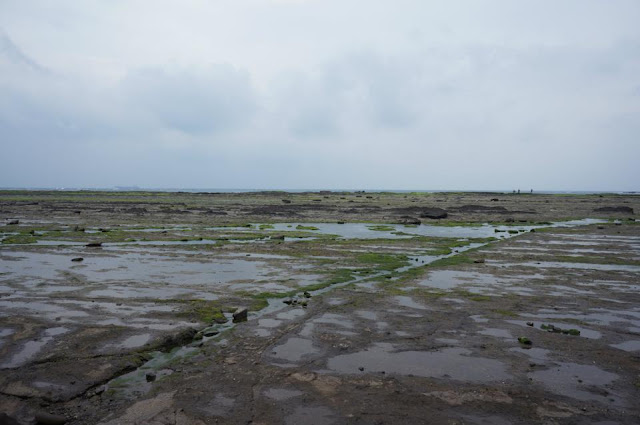
Along this path, you can visit the most amazing beaches on northeast coast. The northeast coast is famous for wave-cut benches. Many creatures live on the benches. You can even see many fish living in the rock holes of the bench. In spring, seaweed grows everywhere and makes the benches totally green.

Besides rock beaches, Fulong also has a famous white sand beach. Many activities are arranged here: swimming, surfing, diving, boating, music concert and sand sculptures.

Fulong is the hometown of delicious food. The most famous Fulong lunch box shop is the first shop on the left as you exit the train station. You can also try cool and delicious seaweed jelly.

Biking around Fulong is the best way to enjoy so many great things at the same time!

Transportation:
Take train to Fulong. There are several bike-rental shops in front of the train station.

Map:


Itinerary: 
09:05 Meet everyone at Taipei Railway Station Lobby South 1 Entrance and take train 4162.(AM. 9:35 NTD 83)
10:58 Arrive Fulong, have lunch and rent Bike. 11:50 Start Biking around Northeast Coast. 13:30. Arrive Maoao, look around fish village and check out traditional stone houses. 14:00 Keep Biking and enjoy the beautiful beach. 16:30 Back to Fulong and take train to Taipei. (Train 4193 PM 16:51) 18:16 Arrive Taipei.

Biking Way from Fulong Train Station

Shicheng 石城

Bike path along the coast

Wave-cut bench

Seaweed

Sandiaojiao 三貂角


Fishermen’s Historic Trail + BA-IAN Hot Spring (魚路古道+八煙溫泉)

Fishermen’s Historic Trail + BA-IAN Hot Spring (魚路古道+八煙溫泉)
By YiRu Li 2013.4.7

Yangmingshan National Park is famous for its volcanic terrain. Volcanic Mountains, fumaroles, and hot springs are the most special scenery in Yanmingshan National Park.
In this trip we’ll visit Da-You fumarole and Ba-Ian Hot Spring through Fishermen’s Historic Trail. It’s a trip we can enjoy the treasures of volcanos and also understand ancestors’ historical activities in this area. After such a great day, let’s enjoy the best wild vegetables and chicken with a dinner at Bamboo Lake!

Dayou fumarole (大油坑) — A former sulfur mining place. Ancient mining equipment and roads are still left around the fumarole.

Ba-ian Hot Spring (八煙溫泉) — Probably the best hot spring in Taiwan! It’s easily reached via public transportation and located at a riverside where hot springs mix with a cold stream. The water is full of minerals which have an excellent healing effect.

Fishermen’s Historic Trail (魚路古道/ 金包里大路) — 100 years ago, this trail was used by fishermen who carried their fish from North coast to sell in Taipei. Today, we still can see many historical remains on this trail: a fishermen’s water-drinking place, villages, terrace fields, stone workshops, bridges and stoves.

Bamboo Lake (竹子湖) Bamboo Lake vegetable and free range chicken — Volcano is not only for watching, it also can be eaten!!! The vegetable in Bamboo Lake is irrigated by hot spring water from Xaio-You Femoral (小油坑). Full of minerals, the vegetables have rich flavors! Free range chickens are raised on the volcanic soil and become super delicious!

Itinerary: 
10:10 Meet everyone at MRT Jiantan Station Exit1 and take bus. (Small 15, NTD15)
11:10 Arrive Cingtiangang (擎天崗) and start hiking. 12:30 Arrive Dayou fumarole (大油坑).   14:30 Ba-ian Hot Spring trailhead (Royal Bus station: 八煙 (綠峰山莊)) 15:00 Arrive Ba-ian Hot Spring. 17:00 Take Royal Bus (1717) back to MRT Jiantan Station. (NTD107, http://www.royalbus.com.tw/) or go to bamboo Lake for dinner 19:00 Back to MRT Jiantan Station.

Transportation:
Cingtiangang (擎天崗): Take bus Small 15 from MRT Jiantan Station Exit1 http://bcbusstop.myweb.hinet.net/r1/r1_small/zs015.htm

Ba-ian Hot Spring:
Up trailhead: Royal Bus(1717) station: 八煙 (綠峰山莊)
Down trailhead: Royal Bus(1717) station: 強薪 (陽明山水、八煙溫泉) or Ba-ian hot spring resort

Map:


Cingtiangang Trailhead

Dayou fumarole (大油坑)

Xu-Yan Bridge (許顏橋): Richman Xu-Yan built this bridge in 1896.

A cliff on Fishermen’s Historical Trail

Ba-ian Hot Spring

Pass stream on the way to Down-Trailhead of Ba-ian Hot Spring

Dinner at Bamboo Lake